Ecological trail “To Sokolyne Berdo”
-
Difficulty
simple -
Distance
2,1 km -
Duration
3 h
-
Wooden sign with the inscription “Kuzii Massif”, 330 m a.s.l.

47.935856, 24.099696
The route starts near a decorative wooden sign with the inscription “Kuzii Massif” on the roadside of the Uzhhorod-Rakhiv highway.
-
The ruins of the hunting lodge of the Habsburg monarchs
47.936103033306495, 24.10332058522386
To the left of the road one can see the ruins of the Habsburg monarchs’ hunting lodge that have survived to this day.
-
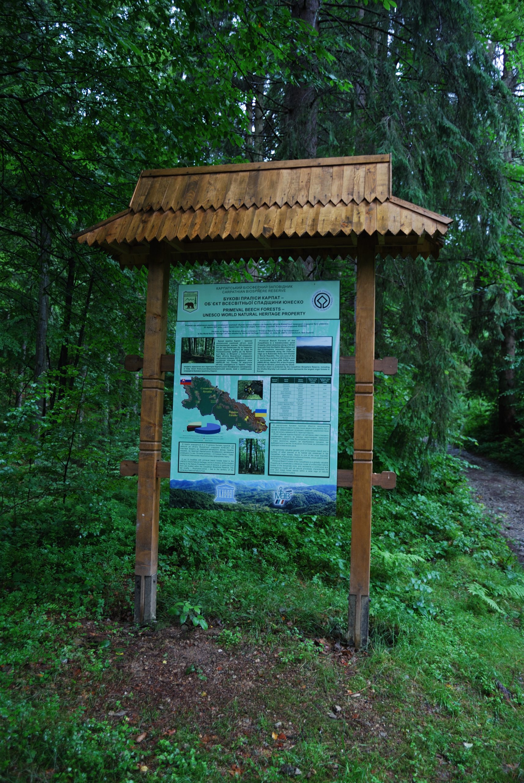
Checkpoint of Kuzii Environmental Research Unit
47.938538, 24.108982
After another 100 m the road is blocked by а boom barrier with information boards installed nearby stating that this is the territory of the Carpathian Biosphere Reserve. In fact, this is the starting point of the route. The route is laid through a preserved area located in the basin of the Kuzii Stream. It passes through a picturesque narrow valley, which is lodged between two peaks – Tempa (1,091 m) and Polianskyi (1,094 m).
-
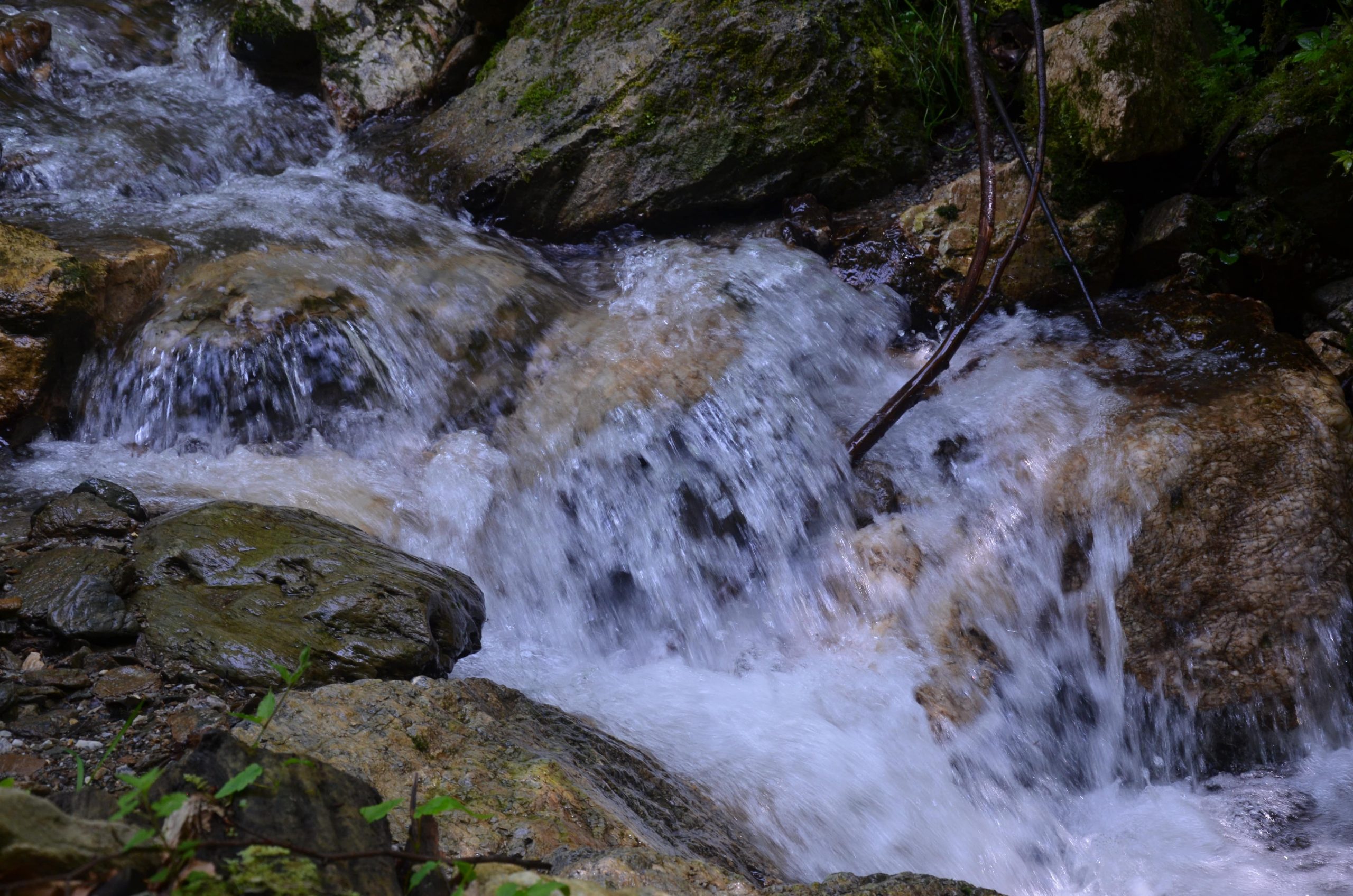
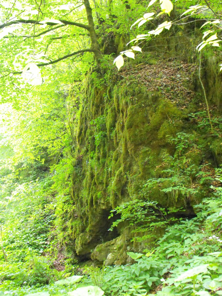
400 m. Waterfall, 360 m a.s.l.

47.938538, 24.108982
A winding path runs along the Kuzii mountain stream, in the valley of which there are picturesque rocky outcrops. There, a two-metre-high picturesque waterfall makes its way through them. A number of rare heat-tolerant ferns (Polypodiophyta) grow directly on the rocks.
-
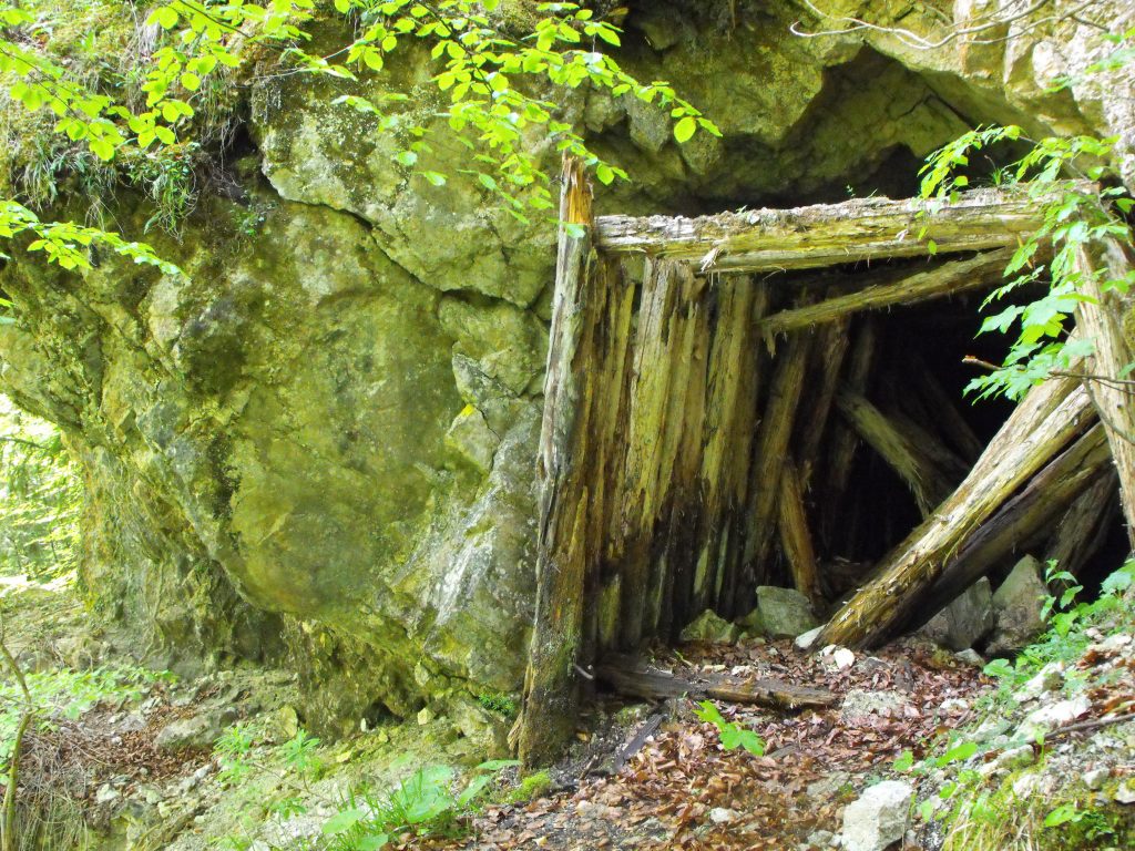
1000 m. Lower adit, 380 m a.s.l.
47.94229886498423, 24.114170777061638
There are two interesting geological monuments on the route – dolomite adits. They were left by geologists carrying out exploration works here in the 1960s. They were looking for gold and other non-ferrous metals. The first adit, 33 m long, is located to the left of the road. 10 species of bats were noticed here, 6 of which are rare species. With a bit of luck you can meet the Aesculapian snake (Zamenis longissimus) there. This non-venomous reptile is the largest in the Carpathians and can reach up to two metres in length.
Warning! It is very dangerous to enter the adit! The timbering is completely rotten in many places; rockfalls occur inside often.
-
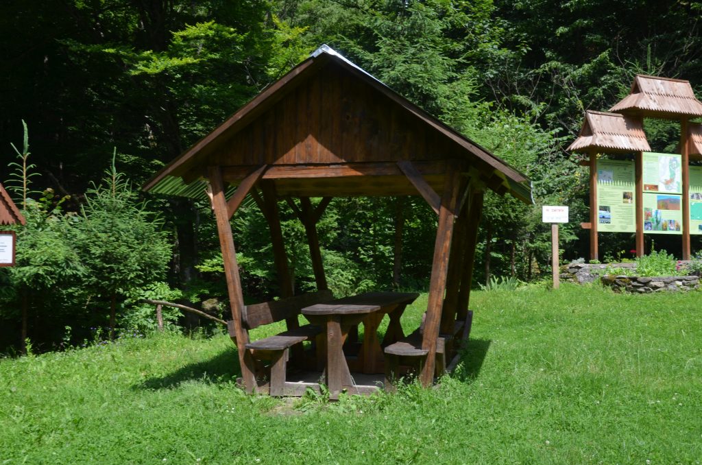
1200 m. Serpentine beginning, 400 m a.s.l.
47.943305, 24.117261
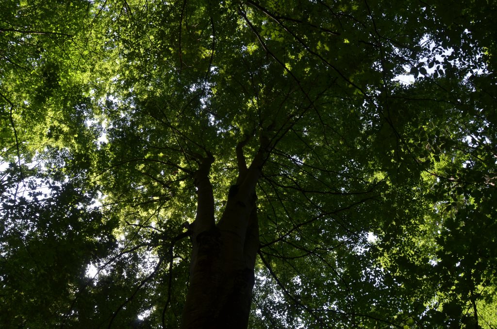
The route reaches the beginning of the serpentine, which extends directly to the Sokolyne Berdo (in the local dialect, the word “berdo” means a steep cliff or a giant stone). Nearby, there is a place for rest, where you can build up strength before long climbing. A winding path leads higher and higher up a slope covered with old beech forest. This preserved area is famous for its unique flora with many rare species. The variety of orchid plants is especially wide here.
-
1,800 m. Upper adit, 530 m a.s.l.
47.94064064542516, 24.124667444449408
The path leads to the second 400-metre-long adit. The larger sizes contribute to the wider habitat of the catacomb. In addition to the already mentioned bats, it is constantly visited by other animals. Here you can often meet the fox (Vulpes vulpes), the marten (Martes), the European polecat (Mustela putorius), and several species of amphibians. In particular, salamanders (Salamandra) constantly overwinter in the adit and even breed in a small stream flowing at its bottom. The fauna of invertebrates inhabiting the adit is rich and interesting. There are real cave-dwellers among them. Large black spiders with bright red spots are especially impressive. Nearby, you can see their batches of eggs in the form of white balls hanging from the vault on a thin web.
Warning! It is very dangerous to enter the adit! The timbering is completely rotten in many places; rockfalls occur inside often..
-
1,940 m. “Sokolyne Berdo”, 560 m a.s.l.
47.93974941888909, 24.126899042344316
We are at the foot of a huge rock wall. This is the Sokolyne Berdo Tract, known for its large yew population, which has been preserved on limestone rocks under the canopy of sycamore and beech forests. Next to the rock wall there are several interesting limestone remnants, resembling giant fingers or broken trunks of huge beeches.
-
2,050 m. End of the route, 700 m a.s.l.
47.93949067282345, 24.127971925947637
The path leads us to a small open area. Actually, this is the end of the route. There are steep cliffs and isolated giant beeches up to 50 m in height.
This place offers a unique panorama of the Kuzii Valley with its primeval oak, beech, mixed and spruce forests. On the opposite slope of the ravine, a large rock massif can be seen – this is the Dovhe Berdo Tract, located at an altitude of 900 m.
Deviation from the route.
Damage to natural objects.
Breeding hearths in places not designated for this purpose, smoking when passing through forests.
Felling and damage to trees plucking flowers, collecting medicinal plants.
Hunting for animals, destruction of their habitats.
Catching fish by any means.
Stay with firearms.
Territory littering, noise.
Report to the Ministry of Emergencies before you go on a hike, so that rescuers can find you quickly and in time if something happens. This requires only two steps:
-
Fill out the online form
Fill in the online form to inform the mountain search and rescue units about the planned trips to the mountains.
Online form -
Save the contacts of rescue units
Make a note in your mobile phones of the mountain search and rescue units of the area in which you are going to travel.
Contacts of divisions