To Pop Ivan Marmaroskyi
-
Difficulty
Strenuous -
Distance
21 km -
Duration
12 h (1-2 days)
-
Dilove village
47.935670659250306, 24.174538438597015
The route begins in one of the most picturesque and interesting settlements of Zakarpattia region – the village of Dilove. It is located 50 metres from the Ukrainian-Romanian border, and there is a geodetic sign and stele “Geographical Centre of Europe” here.
-
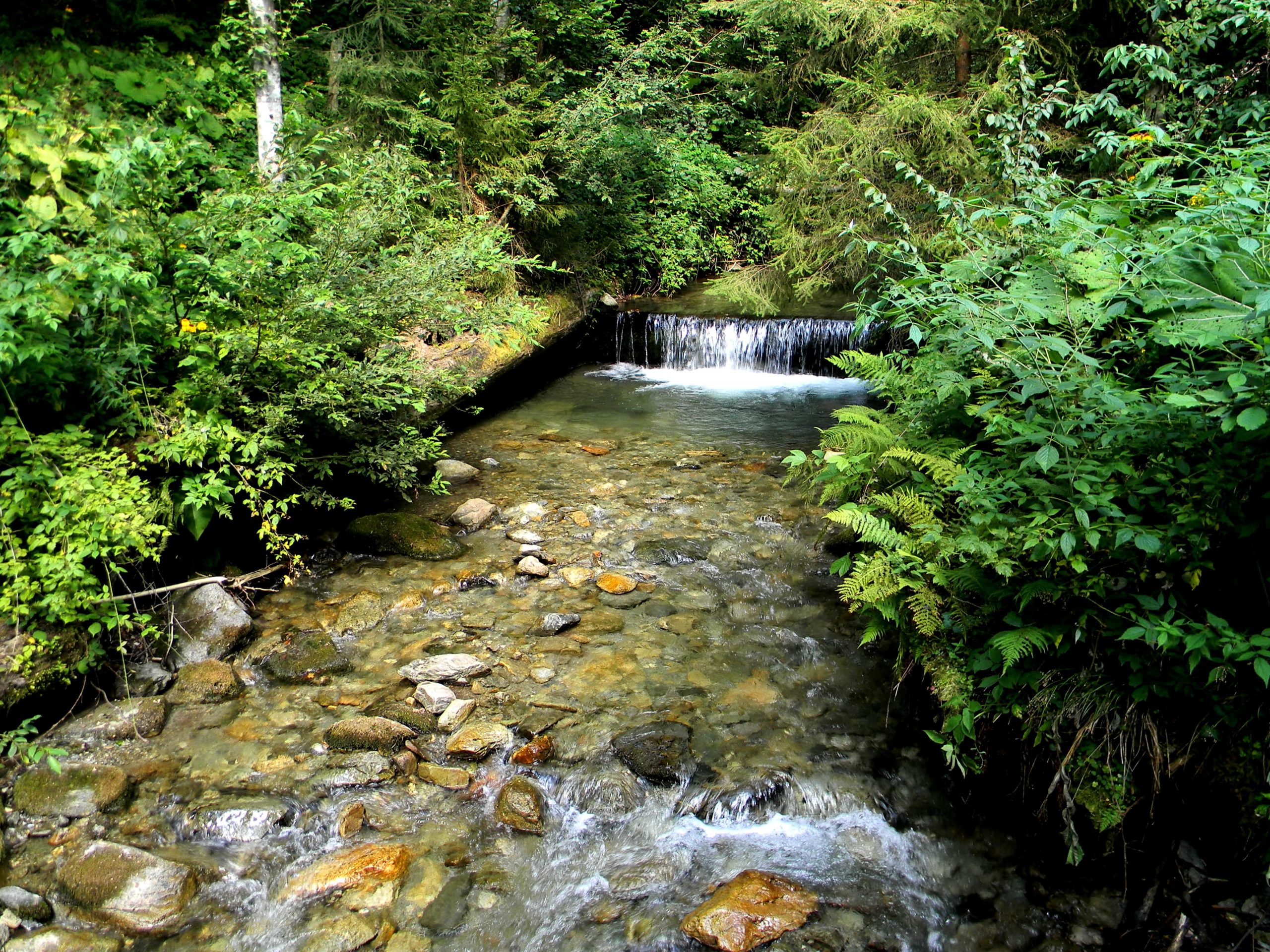
Bilyi Stream

47.92820185033313, 24.2283757379749
Then the route goes along the Bilyi Stream, the valley of which is fairly considered one of the most picturesque in the Carpathians: sharp peaks with steep rocky slopes, fast streams and small waterfalls. The landscapes of the Marmaroskyi massif are the result of the activity of ancient glaciers.
-
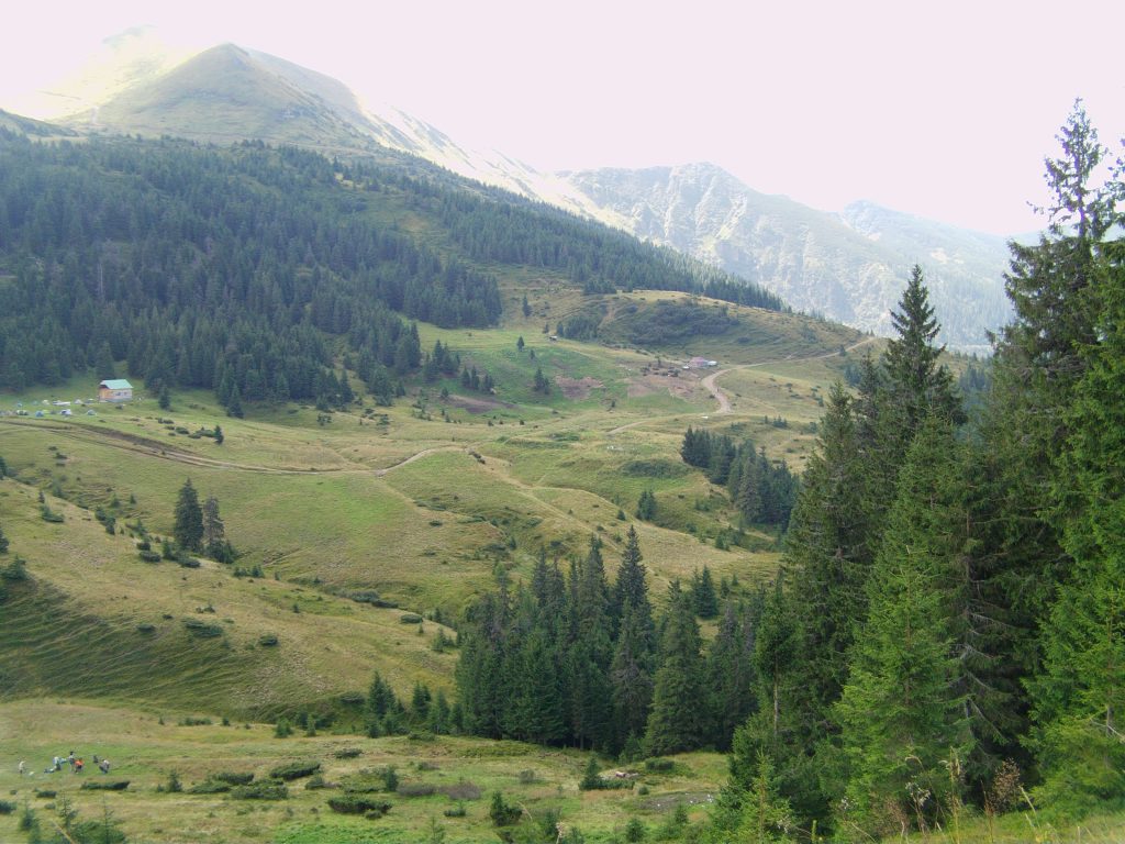
Lysychyi Montane Meadow
47.936425387413735, 24.31613761695581
A dirt track will take you to the Lysychyi Montane Meadow, which is located at the foot of Mount Pip Ivan. To this day, as in ancient times, local shepherds (sheepmen) graze flocks of sheep here and make such traditional dairy products as cheese, vurda (urdă), and bryndzia.
There, through the clouds floating between the picturesque Marmarosy, you can see the highest point of our route – Mount Pop Ivan Marmaroskyi.
-
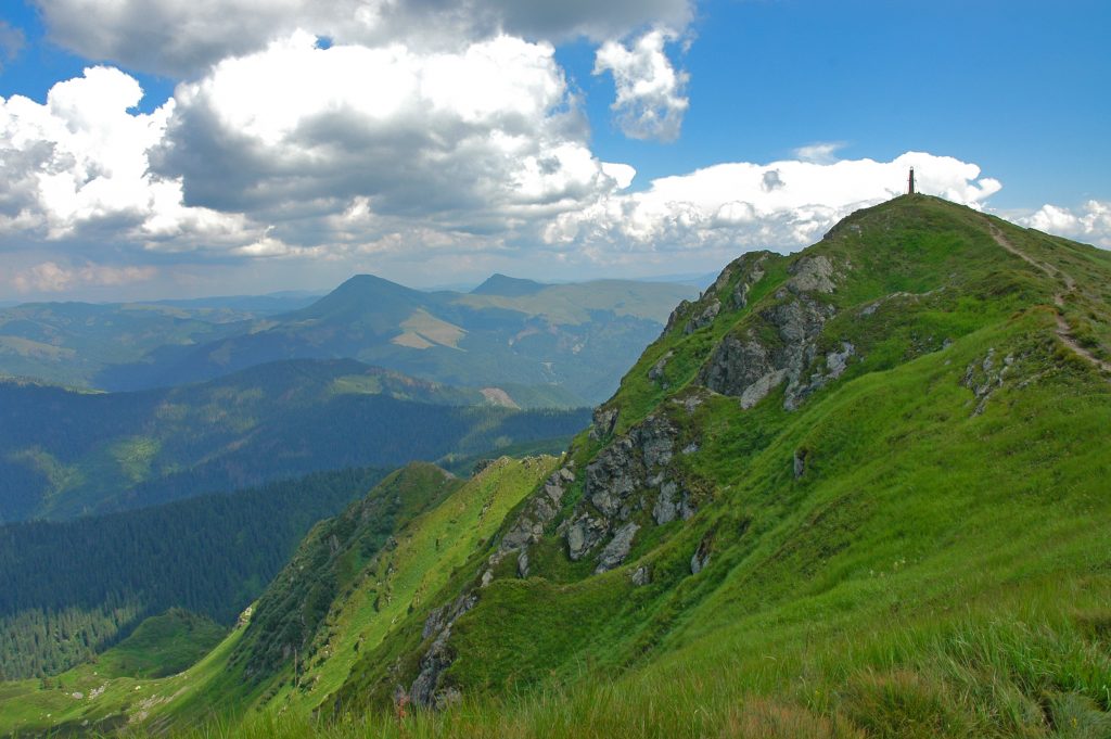
Mount Pop Ivan
47.92435560401249, 24.327874963597424
The mountain stands out for sharp ridges, steep slopes and rocky ledges – no wonder it is called the most impressive peak of the Hutsul Alps.
To pass the route, registration at the border service is mandatory.
Deviation from the route.
Damage to natural objects.
Breeding hearths in places not designated for this purpose, smoking when passing through forests.
Felling and damage to trees plucking flowers, collecting medicinal plants.
Hunting for animals, destruction of their habitats.
Catching fish by any means.
Stay with firearms.
Territory littering, noise.
Report to the Ministry of Emergencies before you go on a hike, so that rescuers can find you quickly and in time if something happens. This requires only two steps:
-
Fill out the online form
Fill in the online form to inform the mountain search and rescue units about the planned trips to the mountains.
Online form -
Save the contacts of rescue units
Make a note in your mobile phones of the mountain search and rescue units of the area in which you are going to travel.
Contacts of divisions