Heading for Petros through Keveliv primeval forests
-
Difficulty
Strenuous -
Distance
12 km -
Duration
4 h
-
Beginning of the route
48.19124488330465, 24.30021604004042
The route begins to the right of Rakhiv–Ivano-Frankivsk highway on the banks of the Chorna Tysa River. 20 km from here, on the outskirts of Rakhiv, the Chorna Tysa merges with the Bila Tysa, forming the Tysa River, glorified in songs and legends, the left tributary of the mighty Danube. Here, one can find interesting small architectural forms with information stands, made in the local style with the use of natural materials – stone and wood.
This place is a kind of tourist crossroads, due to its convenient location between the Chornohora and Svydovets ranges. From here, you can get to the most interesting peaks of the Ukrainian Carpathians – Mounts Hoverla, Petros, Blyznytsi and others.
-
Keveliv Stream Valley
,
200 m further, the route runs along the Keveliv stream, the left tributary of the Chorna Tysa River. The stream originates on the slopes of Mount Petros, and then flows along the riverbed which has been washed in the rocks for thousands of years.
-
Mineral spring, rest area
,
Having walked 800 m further, to the left of the road we find a mineral spring of water rich in hydrogen sulfide, as evidenced by the characteristic rotten eggs smell. Despite this, spring water is very popular among locals who believe it to be healing. There is a wooden gazebo installed nearby, and on the opposite bank, where you can get by crossing a wooden bridge, a rest area is arranged.
-
Rest area 2
,
Having passed 2,200 m more, to the left of the road we will see a rest area equipped near a source of drinking water.
-
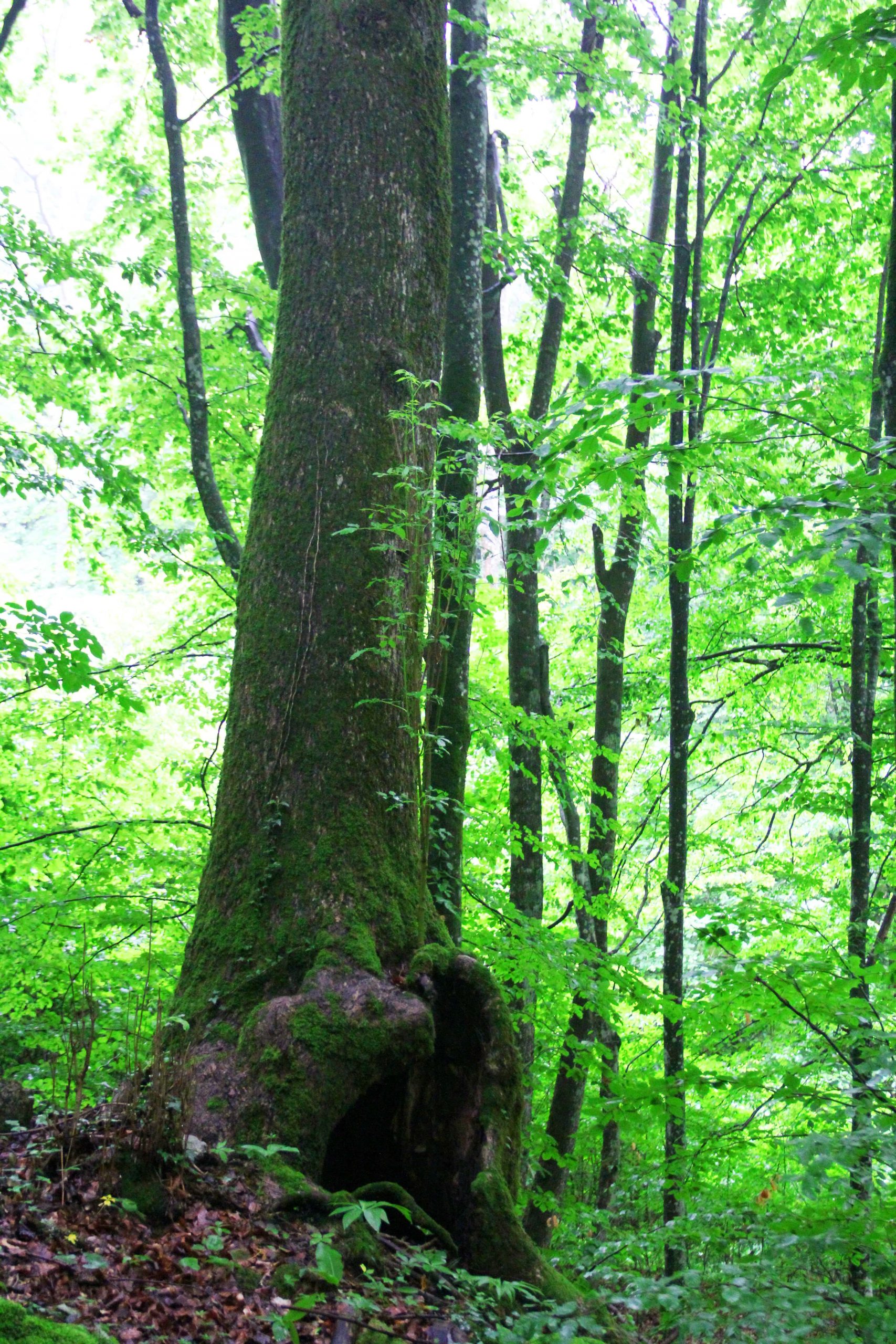
Hollow tree

,
2,300 m from the beginning of the route, to the right of the road, there is an old wych elm (Úlmus glábra) with a hollow at the bottom of the trunk. Even a bear can overwinter in such holes, if they are spacious enough.
-
Rest area 3
,
At 5,100 m of the route, at an altitude of 950 m, we will reach a forest glade with a rest area equipped. From here, the route leads along a mountain serpentine road passing through forestland to the subalpine and alpine highlands.
-
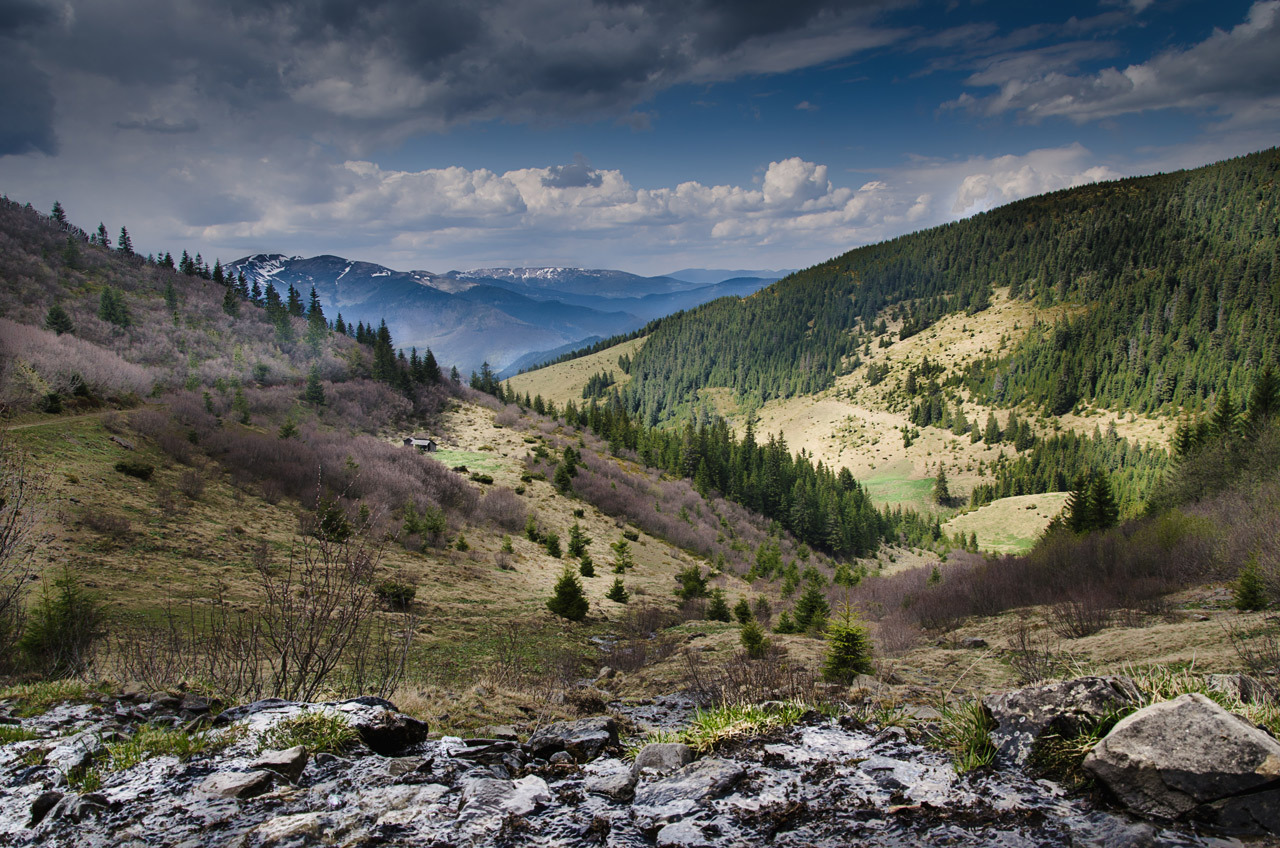
Forestry cutting
,
Leaving 5,600 m behind, the road leads to a forestry cutting, which is more than 10 years old. This place reveals a beautiful view of the Svydovets range, and in clear weather one can admire its greatest highlight – the peaks of Mounts Blyznytsi.
-
Entrance to the primeval forest
,
Here, 5,800 m from the beginning of the route, we get into a real fairy tale! At an altitude of 1,000 m, there are unique primeval forest formations. Beech stands predominate here. Among them, small areas of primeval tall-trunked fir, sycamore and ash forests can be found. Mixed fir stands have the highest productivity here. In pristine nature, the trees reach the height of 42-46 m and up to 1-2 m in diameter.
-
Shumneska Montane Meadow

48.172731263311626, 24.42160249530011
Having passed 12,000 m, we are reaching the Shumneska monatne meadow. In summer, local cattle graze on subalpine meadows. Cattle-breeding on highland meadows is a part of the spiritual and material culture of highlanders. If you continue climbing, in a few hours the mountain trail will lead to one of the highest and most interesting peaks of the Ukrainian Carpathians – Mount Petros (2,020 m). Its name originates from the Latin word meaning “stone”. And indeed, the peak is covered with numerous rocky outcrops and ridges.
Deviation from the route.
Damage to natural objects.
Breeding hearths in places not designated for this purpose, smoking when passing through forests.
Felling and damage to trees plucking flowers, collecting medicinal plants.
Hunting for animals, destruction of their habitats.
Catching fish by any means.
Stay with firearms.
Territory littering, noise.
Report to the Ministry of Emergencies before you go on a hike, so that rescuers can find you quickly and in time if something happens. This requires only two steps:
-
Fill out the online form
Fill in the online form to inform the mountain search and rescue units about the planned trips to the mountains.
Online form -
Save the contacts of rescue units
Make a note in your mobile phones of the mountain search and rescue units of the area in which you are going to travel.
Contacts of divisions